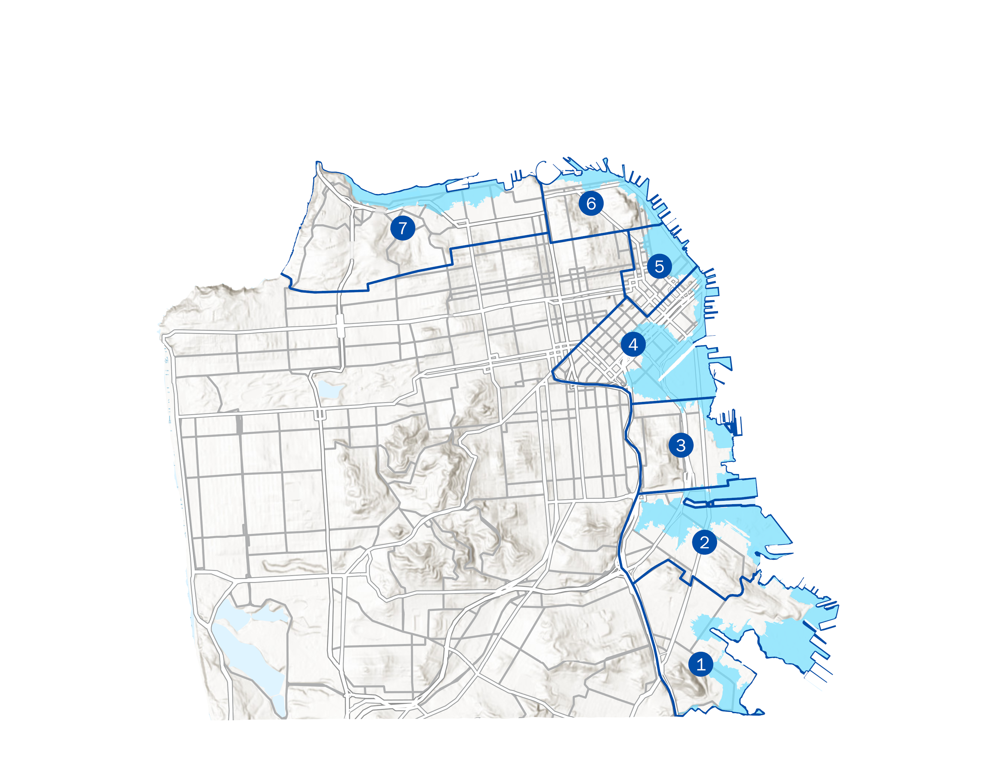
Departments responsible for proposed projects within the projected zone of vulnerability to inundation that could result in Sea Level Rise (SLR) plus a 100-year storm by 2100 will need to address adaptive capacity by completing the SLR checklist available on this page. The checklist must be submitted to the City Engineer by March 1 or in advance of project authorization or funding.*
*Checklists submitted after March 1, 2019, do not need to be re-submitted unless there have been major changes (for example, change in location, delay in construction completion that would impact the planning horizon, and/or increase in size), to the project.
-
Guidance for Incorporating Sea Level Rise into Capital Planning (PDF)
-
SLR Vulnerability Zone map (PDF) – The SLR Vulnerability Zone Map presents the area potentially inundated by extreme SLR plus a 100-year storm in the year 2100. Please see here for the SLR Vulnerability Zone Map (overlaid on San Francisco base layers).
-
Ground elevation Interactive maps.
-
To view the Digital Elevation Model (DEM), select the neighborhood in which your project is located below. Pan and zoom in sufficiently on your project site using the DEM visualization tools to select and record the lowest ground elevation on the project site.
-

-
-
Water levels interactive map:
-
Pan and Zoom using the water levels visualization tool to select and record the relevant elevations closest to your project location.
-
Submission Steps:
-
Identify and map project sites included in the ten-year Capital Plan, a proposal bond program, or submitted within a budget or supplemental request to verify if it falls within the area defined as the SLR vulnerability zone.
-
Fill out the SLR checklist for each of the capital projects over $5 million that have been identified for funding over the next 10 years. Please note that in order to correctly complete the checklist, Departments must review the full Guidance.
-
In cases where projects are at an early stage of development or within a program that does not have specific information but are or might be within the vulnerability zone, inform the capital planning staff and the City Engineer when specific projects will be defined, and the checklist will be completed.
Background:
These instructions were created to establish and apply a consistent and comprehensive review, planning, and implementation process to carry out the “Guidance for Incorporating Sea Level Rise into Capital Planning in San Francisco.”
The Guidance was originally adopted by the Capital Planning Committee on September 22, 2014; revisions and a supplement were adopted on December 14, 2015; and an update was produced on January 3, 2020.

