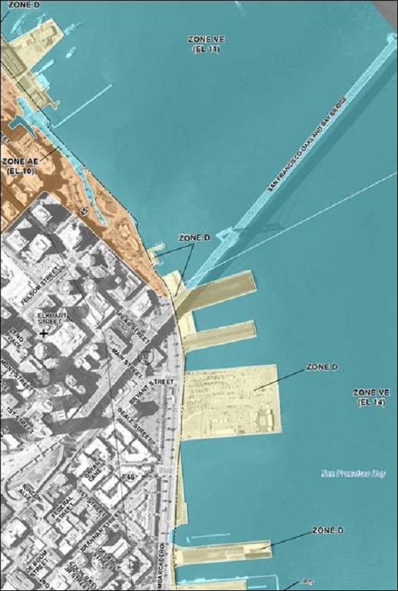
The City and County of San Francisco is a participant in the National Flood Insurance Program (NFIP). Under this program, which is managed by the Federal Emergency Management Agency (FEMA), the federal government makes flood insurance available at affordable rates in the City. Homeowners, renters, and businesses in the City are eligible to purchase federally subsidized flood insurance to protect their properties.
Conditions and Requirements
As a condition of participating in the NFIP, the City has adopted and enforces a Floodplain Management Ordinance intended to reduce the risk of damage from flooding in the City. The Floodplain Management Ordinance governs construction in flood-prone areas and designates the City Administrator’s Office as the City’s Floodplain Administrator.
The ordinance requires that, in designated flood hazard areas, new construction of and substantial improvements to buildings must be protected against flood damage. The ordinance also prohibits uses that would increase flood risks and provides for variances for exceptional circumstances, including historic preservation, maritime uses, and extraordinary hardship. The ordinance was first adopted in 2008 and was amended in 2010 and 2020.
Flood Plain Administration and Rate Maps
As the designated Floodplain Administrator, The City Administrator’s Office through the Deputy City Administrator, coordinates all communications with FEMA regarding the NFIP and the FIRM, coordinates the City's implementation of the Floodplain Management Ordinance, and notifies FEMA and the state NFIP Coordinator of physical changes that can affect flooding conditions, among other responsibilities.
To support the NFIP, FEMA publishes Flood Insurance Rate Maps (FIRMs) that are used for flood insurance and floodplain management purposes in participating communities. FIRMs show Special Flood Hazard Areas (SFHAs) that are defined as areas subject to inundation during a flood having a 1-percent chance of occurrence in any given year (also referred to as the Base Flood or 100-year flood). FEMA notified the City on September 23, 2020 that the FIRM will be “effective” (that is, formally published and required for use for flood insurance and floodplain management purposes) on March 23, 2021. The final FIRM designates coastal flood hazard zones for portions of the waterfront piers, Mission Bay, Islais Creek, Bayview Hunters Point, Hunters Point Shipyard, Candlestick Point, Treasure Island, San Francisco International Airport, and Ocean Beach, which may have implications for development plans and insurance requirements in those areas.
Fact Sheet
FAQs
Summary Sheet
Zone D Guidelines
Information
For Historical documents related to the ordinance, please click here.
Low Cost Insurance
Properties located in Special Flood Hazard Areas
-
To find if your property is located in a SFHA, you may use the City’s Property Information Map. Search for the address, click the Environmental Information link on the left-hand side, and check the Flooding: FEMA Special Flood Hazard Area box under the Map Layers section on the right-hand side here.
-
If your property is in a SFHA, start the floodproofing process here.
Properties located within the Port's jurisdiction
-
If your property is located within the Port jurisdiction (including piers and wharves designated Zone D), visit here.
Meetings
To watch the Floodplain Management Ordinance Learning Session, please click here.
Key Contacts
For information regarding the City’s participation in the NFIP or the City’s Floodplain
Management Ordinance, contact the Floodplain Administrator at floodplainadminstrator@sfgov.org.
Project Team
The City and County of San Francisco Office of Resilience and Capital Planning leads this effort in partnership with the Public Utilities Commission, Planning Department, the Department of Building Inspection, the Port, and the Airport.


