PLANNING: Neighborhood Development
PORT: Port of San Francisco
TIDA: Treasure Island Development Authority
Despite the short-term uncertainty brought on by the economic impacts of the pandemic, San Francisco is expected to grow. In 2023, the population was 808,988, an 8% drop from 2019 but up 4% from 2000. The current draft of Plan Bay Area 2050+, developed by the Association of Bay Area Governments, projects San Francisco will grow by 150,000 households (approximately 300,000 people), and 200,000 jobs by 2050. Though lower than pre-pandemic estimates, these projections still represent significant population and density increases, and planning for sufficient infrastructure to support all residents in all neighborhoods remains as important as ever.
Before 2020, the majority of the new developments in San Francisco were concentrated in the eastern part of the city, including Central SoMa, Market Octavia, Mission Bay, Treasure Island, Central Waterfront (Potrero Power Station + Pier 70), and Candlestick Point. Many of these areas are low-lying and are vulnerable to sea level rise, flooding, and liquefaction, and as former industrial areas have fewer services and infrastructure to support the increases in population, which required planning for targeted improvements in open space, transit, complete streets, and community facilities. Major developments and planning for housing growth in other parts of the City are advancing now as well, notably on the westside and northern parts of the City as part of San Francisco’s broader Housing Element rezoning. Some of these plans and developments have distinctive funding mechanisms, including dedicated development fees and development agreements, while others rely on citywide fee structures.
|
|
|
Overview
Development in San Francisco continues to progress, if at a different pace and trajectory than projected pre-pandemic. Adjusting to current and projected population trends will bring different mixes of needs and uses for impact fees and other infrastructure sources. The City will continue to plan its available capital funds to build San Francisco’s evolving neighborhoods as great places to live, travel, work, and play.
New development, densifying, and repurposing existing sites for housing can bring public infrastructure needs, particularly in areas transitioning from commercial or industrial. As existing residential areas densify, the City will need to monitor usage patterns and the adequacy of the service levels and plan investments as necessary to augment existing facilities and infrastructure. Transportation systems must be made more efficient to handle increased ridership and shifts to different modes. San Francisco’s sidewalks and public right-of-way must be enhanced so that pedestrians can move about safely. Residents must have access to open space that meets the recreational and respite needs of the city’s growing population. Delivering public infrastructure when development requires, helps to create safe, livable neighborhoods and projects for San Francisco’s residents, workers, and visitors. Doing so in a climate of more tightly constrained revenue will be a near-term challenge for the City. Sources to implement infrastructure projects that support economic and neighborhood development projects include impact fees, General Fund, bonds, grants from the federal government, the State of California or private philanthropy, and other local funds such as Proposition K sales tax dollars and revenues from Community Facilities Districts (CFDs). San Francisco also continues to encourage and expedite housing development using Infrastructure Financing Districts (IFDs). As of publication, in addition to redevelopment areas, IFDs have been formed at Treasure Island, Pier 70, Potrero Power Station, and Stonestown, with additional districts pending and on the horizon. More information about this funding source and its policy constraints can be found in the Introduction and in the Capital Sources Chapters.
To accommodate increases in population, over the past two decades San Francisco has amended its General Plan with several area plans, which guide the land use and other aspects of development for a given specific geographic area. The area plans have development impact fees to fund infrastructure located in those neighborhoods – Balboa Park, Eastern Neighborhoods, Market Octavia, Rincon Hill, Transit Center, and SoMa – with a similar fee structure for planned growth in Visitacion Valley as well. Impact fee revenue has declined since the pandemic due to the decline in development taking place. The City continues to seek sources in order to complete priority projects.
Over the past couple years, San Francisco has adjusted its development requirements in order to improve the feasibility and encourage delivery of new housing. Passed in 2023, San Francisco’s inclusionary housing and impact fee reform legislation temporarily lowered inclusionary housing requirements and reduced development impact fees citywide by one-third for projects approved by November 1, 2026. Fee reform also permanently allowed developers to defer 80% of their impact fees from initial permit issuance until Temporary Certificate of Occupancy, which significantly alters the revenue flow for infrastructure improvements. These changes improve financial feasibility and reduce risk for housing builders; however, they will also reduce the amount of fee revenue that will be available to fund public infrastructure projects and extend the timeline of those projects.
Acknowledging decreased near-term demand for office space and the current high commercial vacancy rate, the need for housing citywide, and a goal of bringing new residents and students downtown, policy makers have approved legislation to allow for more housing and greater land use flexibility. Recent legislation was passed to streamline permitting, waive Planning Code requirements, and clarify Building and Fire Code requirements to convert commercial buildings to housing Downtown. Building on these regulatory changes, new legislation at the local and state level will support the financial feasibility of adaptive reuse projects. In March 2024, voters approved Proposition C which waives the real estate transfer tax for adaptive reuse projects, eliminating a significant cost for these projects. The recently passed state bill AB2488 seeks to accelerate the adaptive reuse of commercial buildings by enabling the formation of an enhanced infrastructure financing district (EIFD) downtown. Local legislation has also been proposed to waive development impact fees and requirements, including the Inclusionary Housing fee for adaptive reuse projects Downtown.
In the Central SoMa and Transit Center District plan areas, policy makers have proposed legislation to increase capacity for housing. The primary engine for community benefits in the Central SoMa (and to some extent, the Transit Center District) plans was commercial development and associated impact fees, CFD special taxes, and in-kind direct provisions of facilities. If realized, a shift of land use from commercial to residential would yield a lower financial contribution from impact fees to fund infrastructure projects in these plan areas as thousands of additional housing units are added. Depending on the types of uses that are ultimately built, additional or different infrastructure and community facilities to serve this larger residential population may be needed and new funding sources identified.
Though impact fees and other sources will be constrained in the near term, San Francisco will continue to plan for complete, livable neighborhoods. The City’s Housing Element rezoning effort is premised on proximity to certain core infrastructure and services, such as major transit lines. That broader rezoning relies on generally prevailing existing citywide impact fee structures and is not likely to propose new fees specific to this broad citywide rezoning. The City generally, and the capital plan specifically, need to assume that impact fees, even in the best of economic times, are always a supplemental, and not the primary, source of funding long-term capital needs to support growth.
This chapter includes capital projects from departments, agencies, and programs whose primary objectives are to improve San Francisco’s wide-ranging economic base and plan for its future growth.
|
|
|
Port of San Francisco
The Port of San Francisco is responsible for the 7.5 miles of San Francisco waterfront adjacent to San Francisco Bay. The Port manages, maintains, develops, markets, and leases all of the property in this area. The Port’s operating portfolio is composed of approximately 580 ground, commercial, retail, office, industrial, and maritime leases, including leases of many internationally recognized landmarks such as Fisherman’s Wharf, Pier 39, the Ferry Building, and Oracle Park, home of the San Francisco Giants baseball team.
Port lands must be used consistently with public trust principles for the benefit of all California citizens, to further navigation and maritime commerce, fisheries, public access and recreation, environmental restoration, and commercial activities that attract the public to the waterfront. Urban waterfront developments, including the new Southern Bayfront neighborhood developments proposed in the Mission Rock, Orton, and Brookfield projects, require detailed coordination, review, and approval of many government agencies. The Port has also secured State legislation to allow non-trust uses of specified Port lands and created special financing districts to support waterfront improvements.
Such advances were made possible by developing a common understanding with partner agencies of project objectives and requirements to restore historic structures and improve the waterfront for maritime and public use and enjoyment.
Caring for the Port’s many aging, historic structures while staying true to its public trust mission is a challenge. The Port’s need for capital investments has historically outpaced available funding, leaving a substantial backlog and requiring strategic decisions about how to best manage the Port’s aging assets. The Port has confronted this challenge with dedicated funds, pursuit of new external sources, and strategic prioritization.
Office of Community Investment and Infrastructure
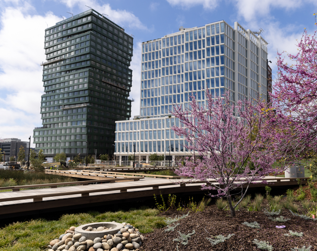
The Office of Community Investment and Infrastructure (OCII) is the successor agency to the San Francisco Redevelopment Agency, which was dissolved in 2012 by order of the California Supreme Court. OCII is authorized to continue to implement the Major Approved Development Projects, which include the Mission Bay North and South Redevelopment Project Areas (Mission Bay), the Hunters Point Shipyard Redevelopment Project Area and Zone 1 of the Bayview Redevelopment Project Area (Shipyard/Candlestick Point), and the Transbay Redevelopment Project Area (Transbay).
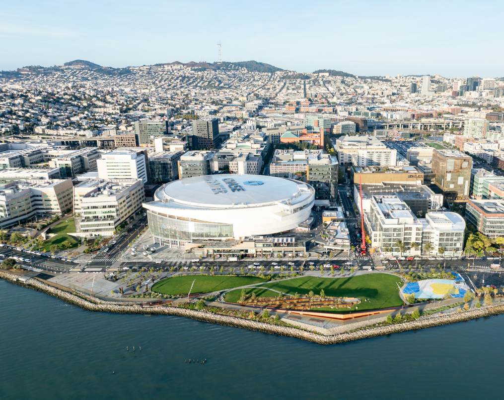
The Mission Bay development covers 303 acres of land between the San Francisco Bay and Interstate-280. The development program for Mission Bay includes market-rate and affordable housing, new commercial space, a new UCSF research campus and medical center, neighborhood-serving retail space, a 299-room hotel, new public open space, and a myriad of community facilities.
The Shipyard/Candlestick Point is comprised of nearly 692 acres of abandoned and underutilized land along San Francisco’s southeastern Bayfront. These long-abandoned waterfront lands will be transformed into areas for jobs, parks, and housing. The development will feature up to 12,100 homes, of which nearly one-third will be affordable, 4.9 million of office and research and development, 2.8 million square feet of retail, community facility, institutional and entertainment uses.
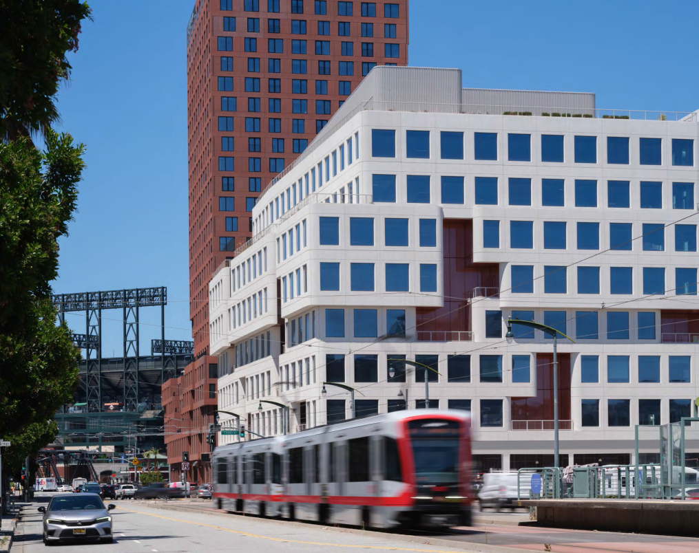
The Transbay development includes the new Salesforce Transit Center and ten acres of former freeway parcels, which OCII and the Transbay Joint Powers Authority (TJPA) are developing into a new, mixed-use neighborhood surrounding a state-of-the-art, multi-modal transit station. The TJPA is responsible for constructing, owning and operating the new Transit Center, and OCII is responsible for the development of the surrounding neighborhood. At full build-out, these publicly-owned parcels will be transformed into approximately 3,300 new housing units, including nearly 1,400 affordable units, three million square feet of new commercial development, and 3.4 acres of parks and open space.
Treasure Island Development Authority
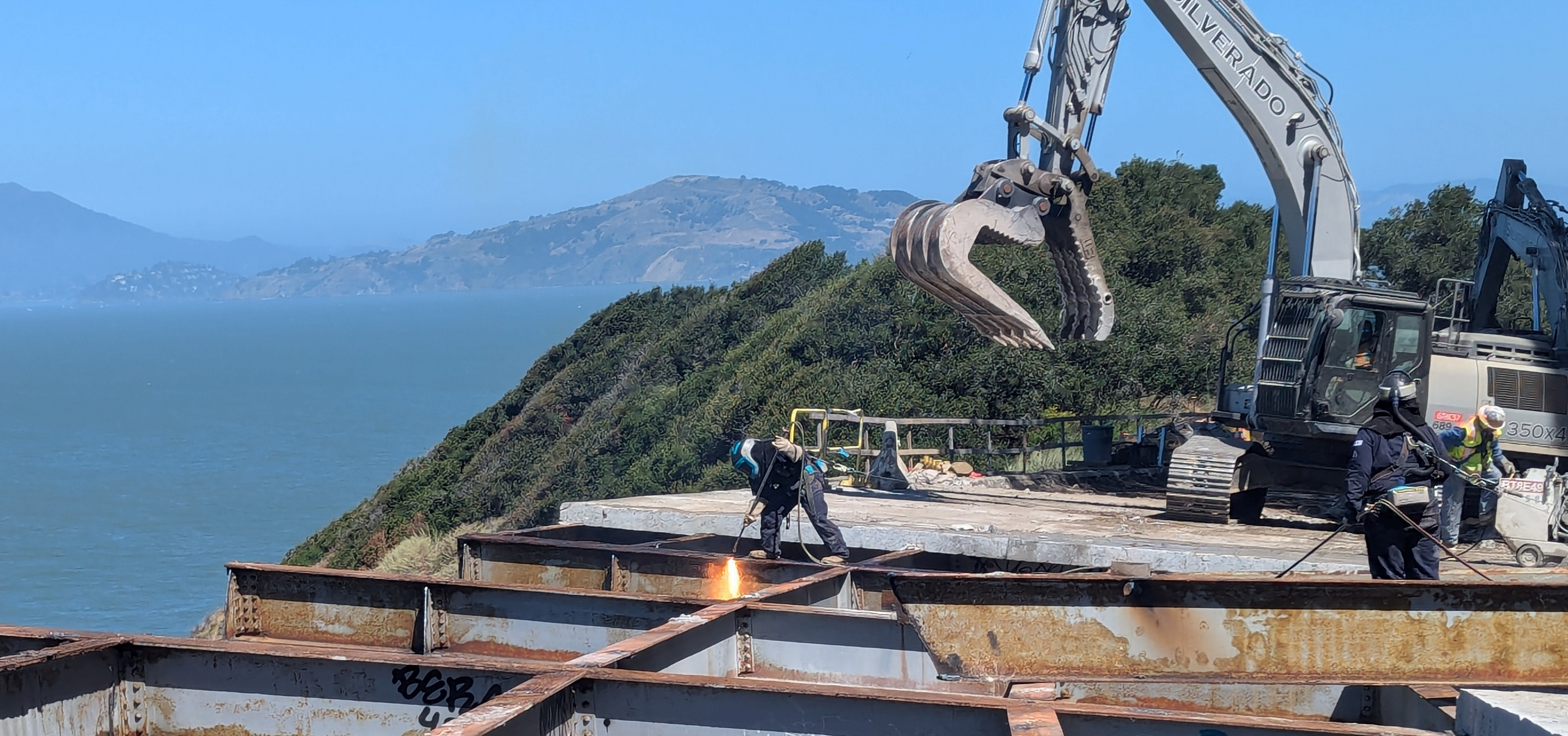
Treasure Island and Yerba Buena Island are in San Francisco Bay, about halfway between the San Francisco mainland and Oakland. Treasure Island contains approximately 404 acres of land, and Yerba Buena Island, approximately 150 acres.
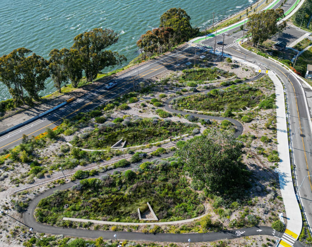
The Treasure Island/Yerba Buena Island Development Project (the Project), is building a new San Francisco neighborhood consisting of up to 8,000 new residential housing units, as well as new commercial and retail space. The Project has completed the first stage of infrastructure, ten acres of new parks and open space and 1000 units of housing. Upcoming work will feature new hotel accommodations and 300 acres of parks and public open space, including shoreline access and cultural uses. Transportation amenities being built for the Project will enhance mobility on the Islands as well as link the Islands to San Francisco. These amenities include new and upgraded streets and public byways; bicycle, transit, and pedestrian facilities; landside and waterside facilities for the existing Treasure Island Sailing Center; an expanded marina; and a new Ferry Terminal.
HOPE SF
HOPE SF is an anti-poverty initiative that works to revitalize San Francisco’s largest and most distressed public housing sites as mixed-income developments. The HOPE SF public housing sites are Hunters View, Alice Griffith, Potrero Terrace and Annex, and Sunnydale and Velasco. All of these projects are former San Francisco Housing Authority sites, now being converted to private management. The real estate and infrastructure component of HOPE SF requires the complete demolition and rebuilding of the four sites along with the creation of new streets, parks and open spaces, and community space that will physically reconnect these sites to their surrounding neighborhoods. These projects also replace and generate new affordable housing units, which is discussed in further detail in the Affordable Housing Chapter.
Planning Department
The Planning Department, in collaboration with other City Departments and the public, develops plans for the City’s existing and evolving neighborhoods to meet the needs of current and future residents, workers, and visitors. Over the last twenty years, community planning to create capacity for more housing has been primarily focused on the southeast part of the city with the adoption of area plans including Balboa Park, Eastern Neighborhoods, SoMa, Market & Octavia, Rincon Hill, and Transit Center. With the adoption of the City’s Housing Element led by the Planning Department in 2023, the City will increase capacity for housing on the west and northern part of the city as well to satisfy the City’s Regional Housing Needs Allocation (RHNA). Together with the Office of Economic and Workforce Development, Planning also leads the implementation of the downtown economic revitalization as part of Former Mayor Breed's Roadmap to San Francisco’s Future.