Building a climate-resilient San Francisco requires both safeguarding against current and future climate hazards as well as eliminating and sequestering harmful greenhouse gas (GHG) emissions. This section describes some of the key initiatives that the City is taking to make San Francisco resilient to immediate and long-term threats of climate change and build a more equitable and sustainable city.
Getting to Net-Zero
Chapter 9 of the environment code codifies San Francisco’s emissions reductions goals of 61% below 1990 levels by 2030, and net-zero emissions by 2040. The 2021 Climate Action Plan (CAP), which is currently being updated for 2025, is the City’s roadmap for meeting these emissions reduction goals. Capital costs, including considerable direct investments in the City’s buildings and infrastructure described below, only represent a portion of the total funding needed to implement the CAP.
Transportation and Land Use
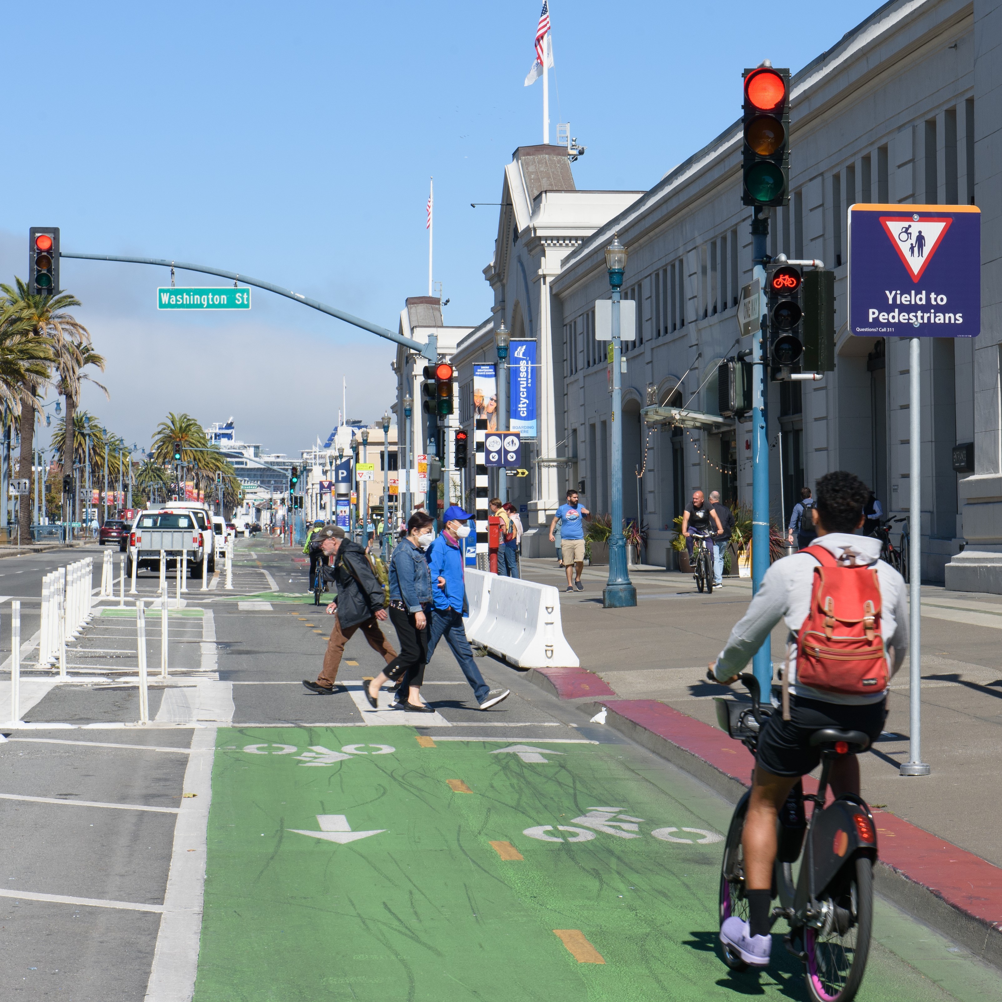
Per the City’s 2022 GHG emissions Inventory, 45% of the City’s total emissions are associated with the transportation sector. The 2021 CAP goals for the Transportation and Land Use sector are for 80% of trips to be taken by low carbon modes by 2030, and for 25% of all registered vehicles to be electric by 2030. The capital investments needed to support these goals primarily relate to the City’s transit system, its active transportation network, and its municipal fleet. The Municipal Transportation Agency (SFMTA) Climate Roadmap (2023) includes specific opportunities to support these emissions reduction goals.
Public Transit
One key strategy in the Roadmap is to “build a fast and reliable transit system that will be everyone’s preferred way to get around”. These plans include advancing major transit capital projects, including a new Geary Subway line and a Central Subway extension. Other important actions include implementing a “Five-Minute Network” (the infrastructure required to have service every 5 minutes or better on core transit corridors) and other important improvements and modernizations to the Muni system. The cost of implementing these improvements through 2050 is approximately $34.5 billion in 2022 dollars.
SFMTA is also working towards a zero-emission bus fleet in support of the City’s CAP. It is currently in the process of evaluating how to transition facilities to support an electric bus fleet through its Building Progress Program to rebuild and upgrade our most obsolete yards. This process includes several pilot projects to validate technology decisions that can work at a larger scale. SFMTA’s 20-Year Capital Plan includes an eBus Facilities Conversion project at an estimated cost of $782 million in 2022 dollars. For more details on planned and deferred transit and transportation network investments, see the Transportation Chapter.
Another key strategy in the Roadmap is to “create a complete and connected active transportation network that shifts trips from automobiles to walking, biking, and other active forms of transportation modes. The types of needed capital investments include protected bicycle lanes, Slow Streets, bicycle parking, and access to active transportation options at transit stops. The cost of implementing these improvements through 2050 is estimated to cost $898 million in 2022 dollars. SFMTA is in the process of completing a Biking and Rolling Plan by early 2025, which will provide more detail on the needed investments, especially in the near term.
Electric Vehicle Charging
A third strategy in the Roadmap is to “accelerate adoption of zero-emissions vehicles (ZEVs) and other electric mobility options”. Charging infrastructure is needed across the City in order to make the transition to electric vehicles more attractive and accessible to people and organizations. The types of needed capital investments include expanding the number of charging stations to at least 10% of spaces in municipally owned parking lots, and explore curbside EV charging through a feasibility study. The cost of implementing these improvements through 2050 is approximately $161 million in 2022 dollars.
Fleet Decarbonization
Finally, San Francisco plans to decarbonize its (non-revenue) fleet of light-, medium-, and heavy-duty vehicles to both align with its emissions reduction goals and comply with state “Advanced Clean Fleet” regulations. The Administrator’s Office estimates that $30 million in 2024 dollars is needed to install an estimated 1,500 chargers for its light-duty vehicles. Importantly, these estimates do not include the potential costs associated with electrical grid upgrades that will be needed to support increased charging capacity across the City. The City has already secured an initial investment of $5 million for charging infrastructure. Investments in alternate fuel technologies such as hydrogen fuel cells are likely needed to fully decarbonize the City’s heavy-duty vehicle fleet.
Building Operations
Per the City’s 2022 GHG Emissions Inventory, 44% of the City’s total emissions are associated with the building sector. The CAP establishes zero-emission targets for large commercial buildings by 2035, and all buildings by 2040. A key strategy to achieve this goal is to phase out natural gas equipment with efficient and all-electric equipment. Achieving this mostly relies on investment by private building owners, but large investments in City-owned facilities will also be required.
Municipal Buildings
Four percent of the City’s emissions come from municipal buildings—which has been slightly increasing since 2015. Chapter 7 of the San Francisco Environment Code mandates that all new municipal buildings and major renovations must be fully electric, eliminating fossil fuel use for heating, cooling, water heating, and cooking. Additionally, it requires existing building systems to be electrified upon equipment replacement or failure. City departments must inventory gas-using equipment in their buildings using an application developed and managed by SF Environment. To date, 228 buildings are included in the current inventory.
A 2019 San Francisco Public Utilities Commission (SFPUC) natural gas consumption study estimates that 31% of annual natural gas consumption could be eliminated through projects currently in process or through mechanical retrofits in the next 10 years. The study also provides cost estimates for six example projects that range from $100,000 to decarbonize 1 South Van Ness to $500,000 million to decarbonize the San Francisco Airport. Electric infrastructure upgrades and building improvements will also likely to be needed for most existing-municipal-building electrification projects. According to the SFPUC, interconnection costs alone are expected to range from $1.2 to $3.3 million per building.
In addition, Chapter 7 requires implementing solar and energy storage capabilities at Critical Community Institutions to provide carbon-free emergency power. The requirement applies to new construction, and major renovations at public safety facilities, health clinics, community centers, libraries, and emergency management facilities. The total capital cost associated with this requirement is estimated to fall between $247 million to $1.58 billion in electrification costs for 332 municipal buildings.
Energy Supply
As of 2022, 89% of the electricity consumed by the City is generated from renewable sources. The City’s CAP sets a goal to achieve 100% renewable electricity by 2025, and 100% renewable energy by 2040 (meaning no fossil fuels). A key strategy to achieve this is to provide 100% renewable electricity at affordable rates which will then facilitate the decarbonization of buildings and transportation.
The CAP calls for a “decarbonization master plan,” which would map out strategic decommissioning of the natural gas system to accompany electrification efforts. The master plan would also aim to protect low-income ratepayers during this transition.
Achieving the CAP’s energy supply goals requires investment in distribution infrastructure, including acquisition of PG&E’s assets serving the city, to provide clean, reliable and affordable electricity. Fully controlling electrical delivery would also allow San Francisco to advance equity in electric service and workforce development. The City and County submitted a petition with the California Public Utilities Commission (CPUC) requesting a formal determination of the value of PG&E’s local electric infrastructure, which is the next step in the City’s efforts to acquire the utility’s city-based electric facilities and complete the transition to public power. The request comes after the City made a $2.5 billion offer in 2019 and again in 2020 to purchase PG&E’s local electric assets.
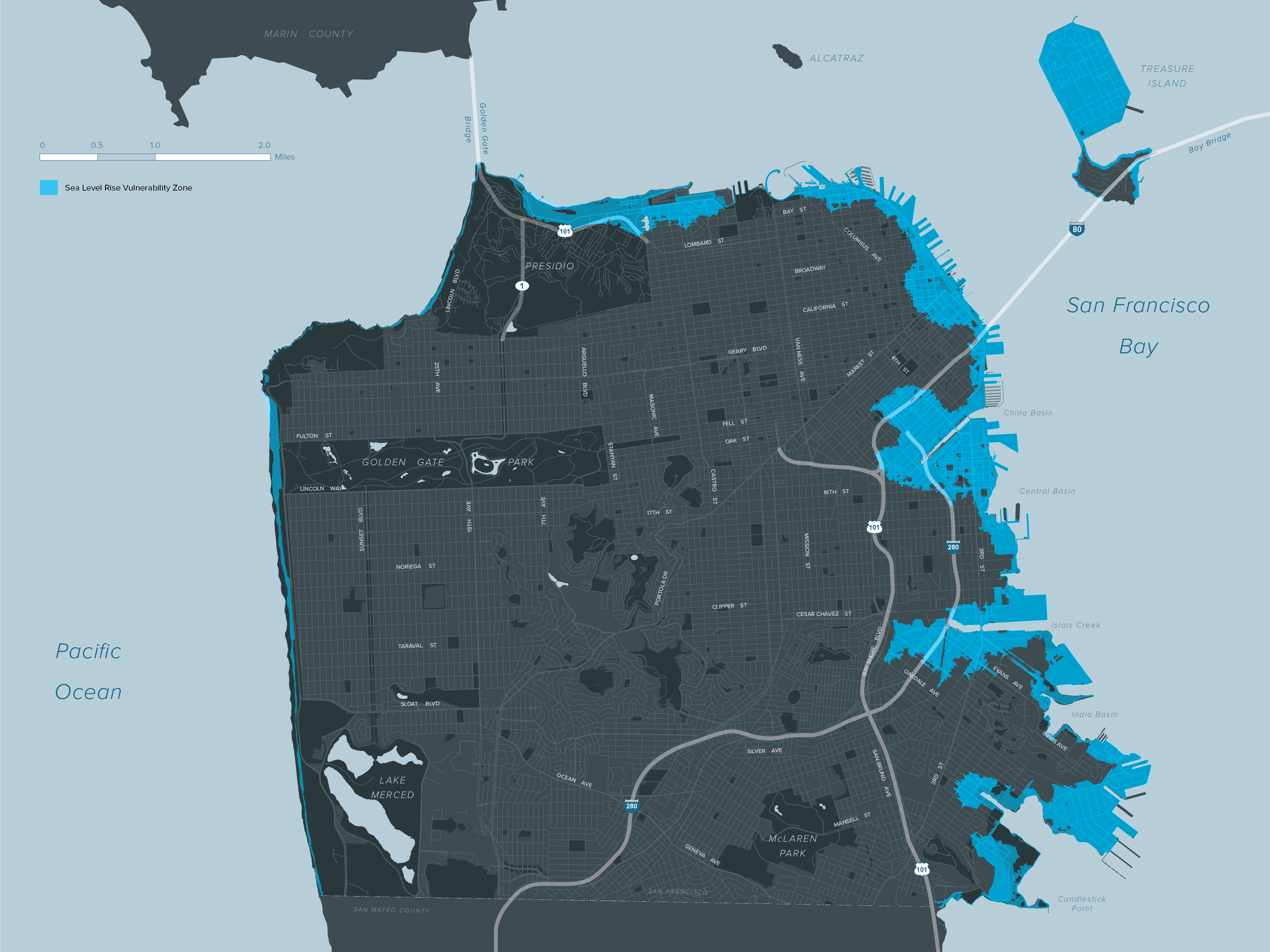
Sea Level Rise and Flooding
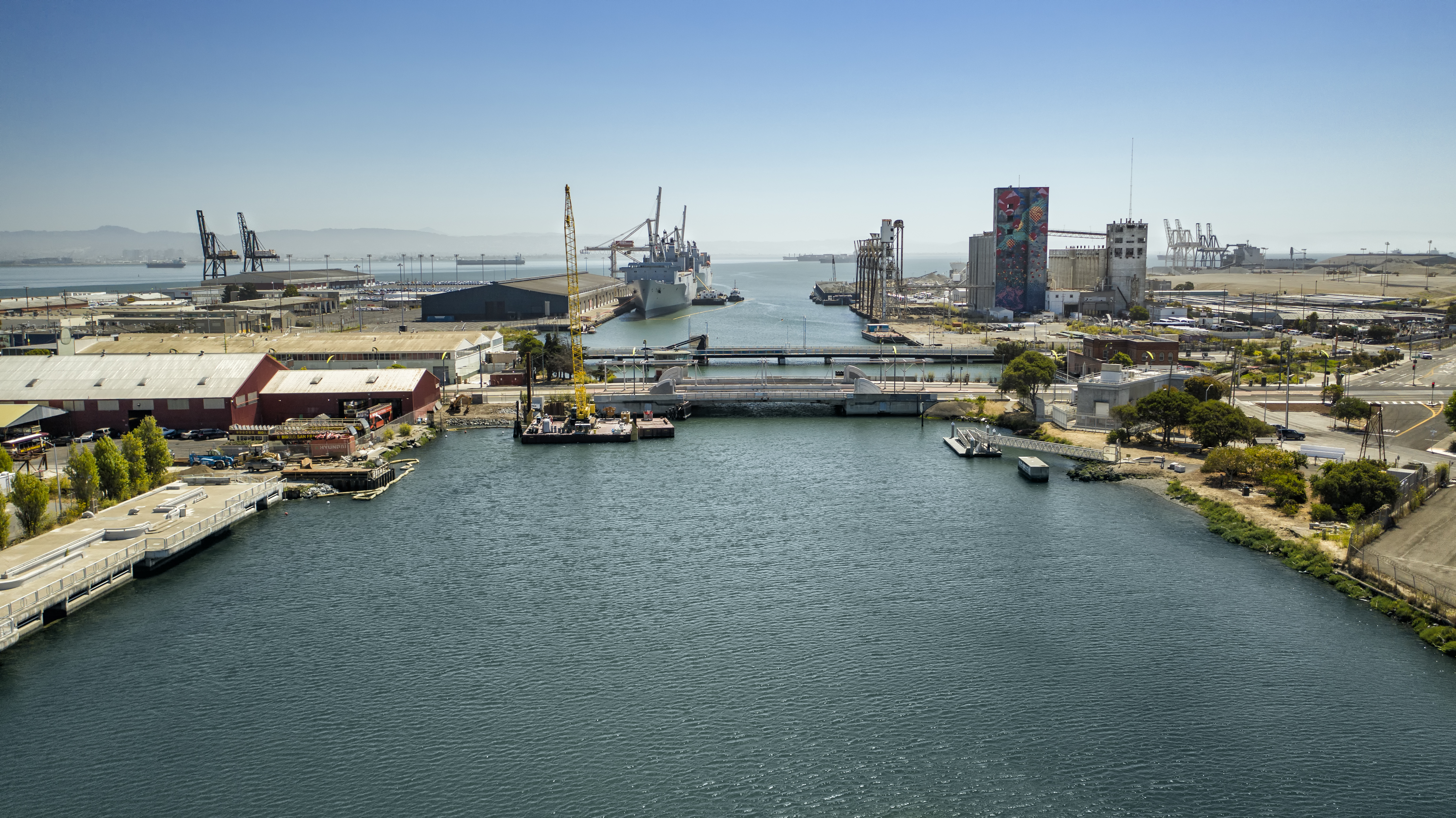
San Francisco faces coastal flood risks today that will increase as sea level and groundwater rises and extreme storms become more frequent. Historic buildings, small businesses, popular attractions, open spaces, and critical services such as BART, Muni, and the wastewater system are all vulnerable. To defend against these flood risks, San Francisco is working to adapt the shoreline, while also strengthening the waterfront for the risk of a major earthquake. By working with the US Army Corps of Engineers, the City has a once-in-a-generation opportunity to defend itself from future floods and earthquakes, improve and rejuvenate the waterfront, enhance the connection to the San Francisco Bay and nature, and bring benefits such as more open space, enhanced mobility, safety, and jobs to residents, commuters, and visitors. This program and other efforts are discussed below.
Sea Level Rise Guidance
San Franisco has been a leader in planning for sea level rise through its Sea Level Rise Guidance for Capital Planning, which was adopted in 2014 and updated in 2020. This Guidance is currently being updated to align with new sea level rise science and guidance from the State. For any capital project greater than $5 million and located in the City’s Sea Level Rise Vulnerability Zone, a project manager must complete a checklist demonstrating that the project has been analyzed for sea level rise vulnerability and risk and appropriate adaptation measures have been incorporated.
San Francisco Waterfront Coastal Flood Study (Flood Study)
Adapting to sea level rise requires going beyond individual assets to include entire areas of the shoreline. The Port of San Francisco’s Waterfront Resilience Program works to ensure the waterfront, and its critical regional and citywide assets, are resilient to hazards while also increasing waterfront accessibility. The U.S. Army Corps of Engineers (USACE) and the Port have partnered on the San Francisco Waterfront Coastal Flood Study (Flood Study) to study the costs and benefits of building coastal flood defense infrastructure and companion inland drainage infrastructure along the San Francisco shoreline from Heron’s Head to Fisherman’s Wharf. The USACE Draft Plan released in early 2024 will inform subsequent stages of funding and design in order to develop targeted construction projects. The proposed solutions are estimated to cost $13.5 billion in 2024 dollars. If it is approved by Congress, the federal government would pay 65% of the cost, leaving the remaining 35% or $4.7 billion to come from local and state sources.
Securing the local and state matching funds will require a concerted citywide effort. In 2017, Mayor Edwin Lee convened a Seawall Finance Working Group led by the Office of Resilience and Capital Panning with support from the Port, City finance experts, and private sector leaders, to generate a set of potential revenue measures, including a $425 million Seawall Earthquake Safety Bond passed by voters in 2018. The recommendations also prompted City advocacy for urban waterfront resilience funding, which was included in State Proposition 4, which voters approved in the November 2024 election.
New sources of funding will be required to unlock the federal funding available through USACE after Congress authorizes the project. The 2028 San Francisco G.O. Bond schedule includes $200 million from the 2028 Waterfront and Climate Safety Bond. The Port of San Francisco is pursuing a strategy to focus a significant portion of remaining Proposition A funding on projects that can qualify for local match credit. Even with these efforts, a new comprehensive funding strategy is needed to (1) develop the required local matching sources and (2) relieve the Port’s capital budget of the sole obligation to fund non-bond eligible expenses associated with the Waterfront Resilience Program.
Shoreline Adaptation Plan
Shoreline adaptation planning extends beyond the Port’s jurisdiction to the north and south. The City is continuing to pursue state and federal funding opportunities to bring necessary investments to Bayview Hunters Point that address future flooding and advance environmental justice. The Yosemite Slough Neighborhood Adaptation Plan will develop strategies to protect the slough and surrounding communities from sea level rise through the end of the century. The project is designed to advance racial & social equity, cross-sector collaboration, and community capacity in planning for multiple climate risks.
San Francisco will also be developing a comprehensive Shoreline Adaptation Plan that addresses sea level rise as required by state legislation (SB 272). This will help ensure that all vulnerable segments of the shoreline are addressed in one plan. The plan will update past assessments with current science, such as groundwater rise risks, provide additional community engagement opportunities, and incorporate additional adaptation strategies tailored to local needs.
Ocean Beach
In San Francisco, the bay shoreline is generally more vulnerable to sea level rise due to its lower elevation than Ocean Beach, however, adaptations remain necessary to protect Ocean Beach from rising sea levels. A number of City, state, and federal agencies are working to adapt Ocean Beach to climate change and coastal erosion. Erosion is expected to worsen with sea level rise, further threatening roads and sewers, and causing the beach to narrow. The Ocean Beach Climate Adaptation Project will change the roadway south of Sloat Boulevard, modify public access, alter coastal management, protect critical infrastructure, and prepare Ocean Beach for a changing climate. Agencies are working together with beach users and community members to adapt to these coastal changes and protect critical infrastructure while supporting open space, recreation, and natural habitat. The cost of the Ocean Beach Climate Adaptation Project (south of Sloat) is approximately $130 million through FY2035. Costs beyond the 10-year horizon are currently unknown.
Projects and plans for Ocean Beach north of Sloat Boulevard include work to identify funding, partnerships, and community stewardship to implement nature-based solutions to restore dunes and reduce erosion. The Ocean Beach Master Plan and San Francisco Estuary Institute (SFEI) Dune Study call for sand replenishment between Santiago Street and Sloat Boulevard to reduce coastal erosion. The Great Highway Pilot Project will help determine how the Great Highway will be used in the future as a recreational space.
Extreme Precipitation
San Francisco is also looking at stormwater flooding. With funding from a number of departments, the SFPUC completed the Extreme Precipitation Study in conjunction with Pathways Climate Institute and Lawrence Berkeley National Laboratory (LBNL). The Study predicts future storms are likely to be more intense and severe as the climate warms. The combined sewer system cannot handle larger predicted storms, so future plans will need to include infrastructure adaptation measures to reduce flood risk. The City is also studying how flood policies and governance may need to change to better manage extreme precipitation.
Heat and Poor Air Quality
San Francisco is a historically temperate city with buildings and infrastructure developed for our cool coastal climate. As extreme heat and wildfire smoke events become more frequent and more extreme, this infrastructure is less able to protect vulnerable San Franciscans from health impacts. Extreme heat and poor air quality sit at the intersection of public health and the built environment and the ability of our buildings and infrastructure systems to protect against these hazards has a direct impact on health outcomes. Adaptation of buildings and infrastructure is critical for protecting the health and wellness of San Franciscans, and for ensuring continuity of operations during hazard events.
The Heat and Air Quality Resilience Project (HAQR) identifies, plans, and implements medium-to-long-term extreme heat and wildfire smoke strategies. It focuses on the resilience of disproportionately impacted frontline and BIPOC communities. This is achieved by creating strategies between the City and community based organizations to advance equity.
A particular focus of HAQR is to support extreme heat and air quality adaptations to the City’s public and private building stock. HAQR elevates extreme heat and wildfire smoke resilience as a building rehabilitation goal, amplifies policies with heat and air quality resilience co-benefits, identifies new funding streams, and puts together best practices.
HAQR also supports the expansion of green infrastructure city-wide by targeting investments to address urban heat islands and neighborhoods with heat-related health burdens. These nature-based solutions will increase equitable outcomes for neighborhood residents and align with the CAP’s residential carbon sequestration objectives. The HAQR Green Infrastructure Priority Zones show areas where future projects are likely to have the biggest benefit.