Balboa Park
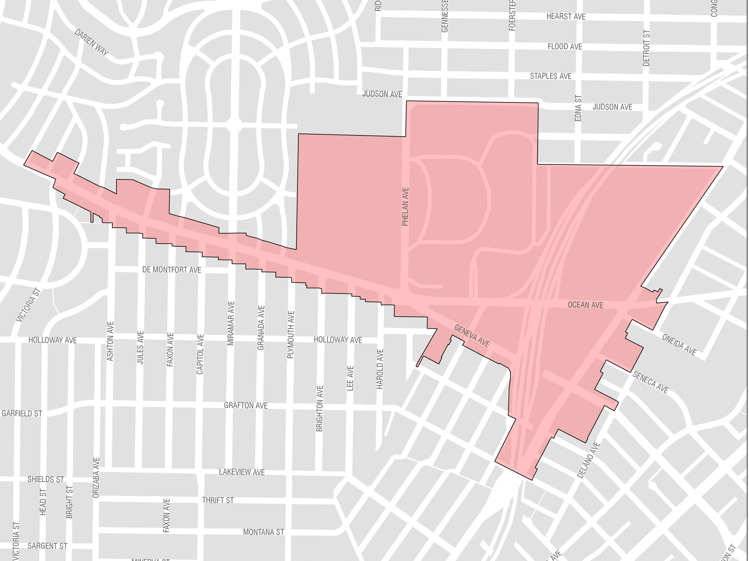
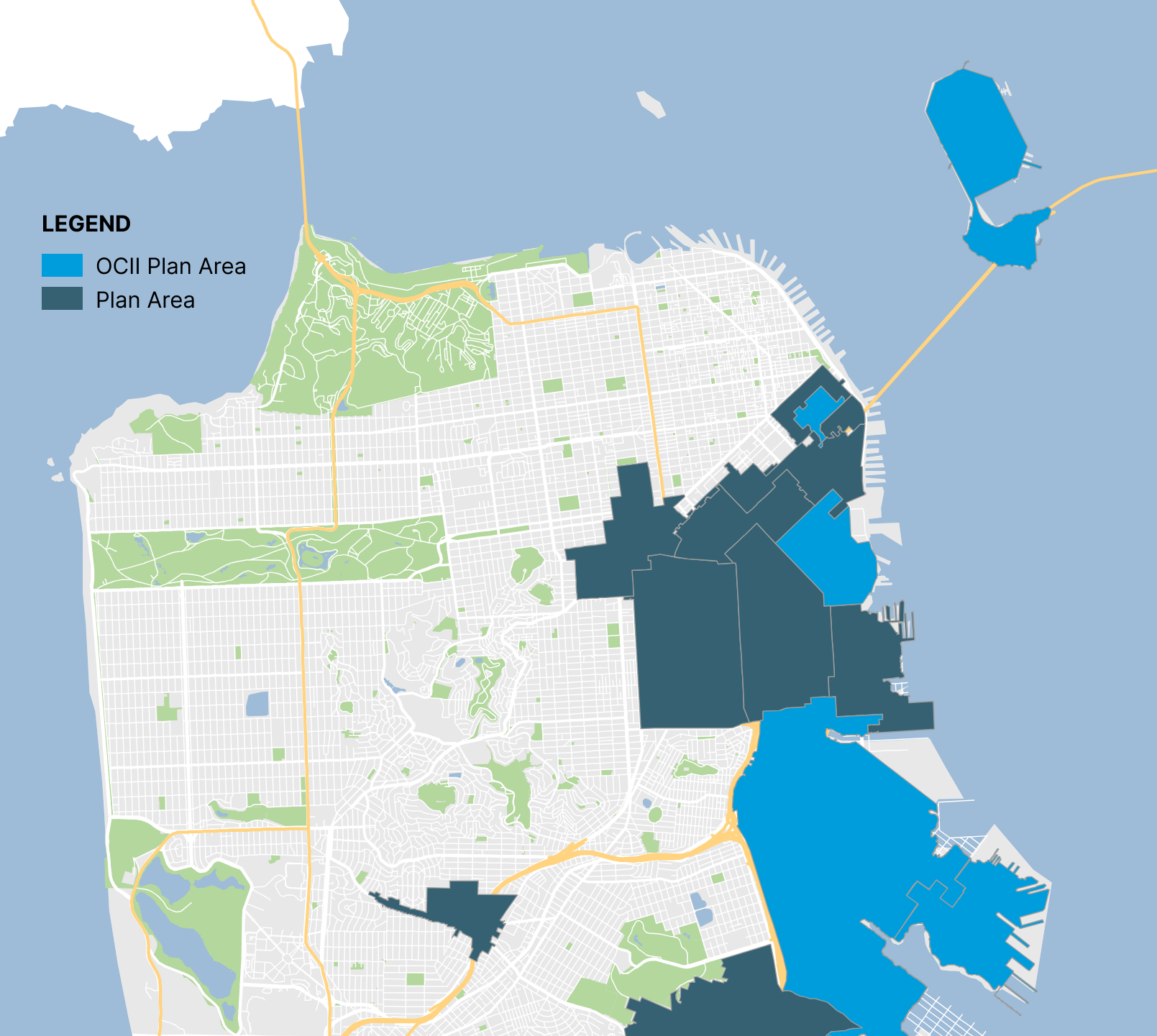
Balboa Park is located in southern San Francisco and provides several amenities that can be leveraged to promote a more livable neighborhood. The area includes the Ocean Avenue campus of the City College of San Francisco, the Ocean Avenue Neighborhood Commercial District, Balboa Park, and the Balboa Park BART station. The area is home to the Balboa Park Reservoir, where 1,100 units of housing are slated for development.
Eastern Neighborhoods
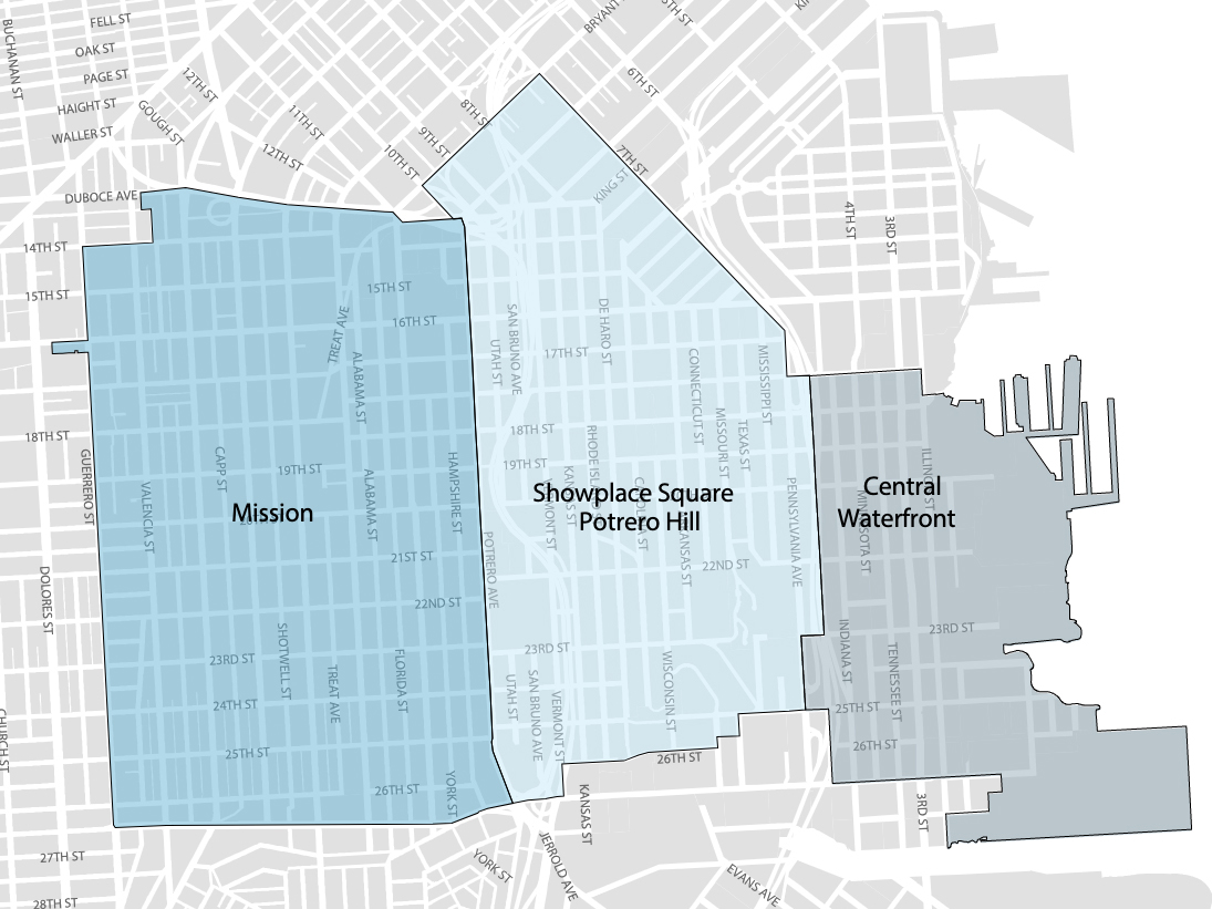
The Eastern Neighborhoods Area Plan consists of several smaller neighborhoods, including the Mission, Showplace Square/Potrero Hill, and Central Waterfront. Much of the land use in the Eastern Neighborhoods was historically dedicated to industrial uses, and production, distribution, and repair. Over time, residential and commercial uses have grown. In 2010, population in the Eastern Neighborhoods Plan Area was 83,930. The Planning Department projects the population to reach 149,570 by 2040, an increase of 78%.
SoMa
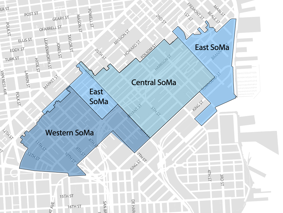
SoMa includes three Area Plan geographies: Western SoMa, Central SoMa, and Eastern SoMa. The Central SoMa Plan is the most recently approved, enables the most significant amount of additional growth, and creates the greatest amount of potential revenue through new impact fees and the establishment of a CFD to pay for new infrastructure projects. The vision of the Central SoMa Plan is to create a social, economic, and environmentally sustainable neighborhood by 2040, with space for approximately 32,000 new jobs and 8,600 new housing units. The Plan is expected to result in up to $2.2 billion in public benefits to serve critical needs of the neighborhood, including affordable housing, transportation, streets improvements, parks and recreation, schools, environmental sustainability, and community services. Funding for these projects will be derived from a combination of new and existing impact fees, CFD special tax revenues, direct provision by developers, and various other sources of funding. These funds will be received as development occurs in the Plan Area over the next 25 years.
Market Octavia
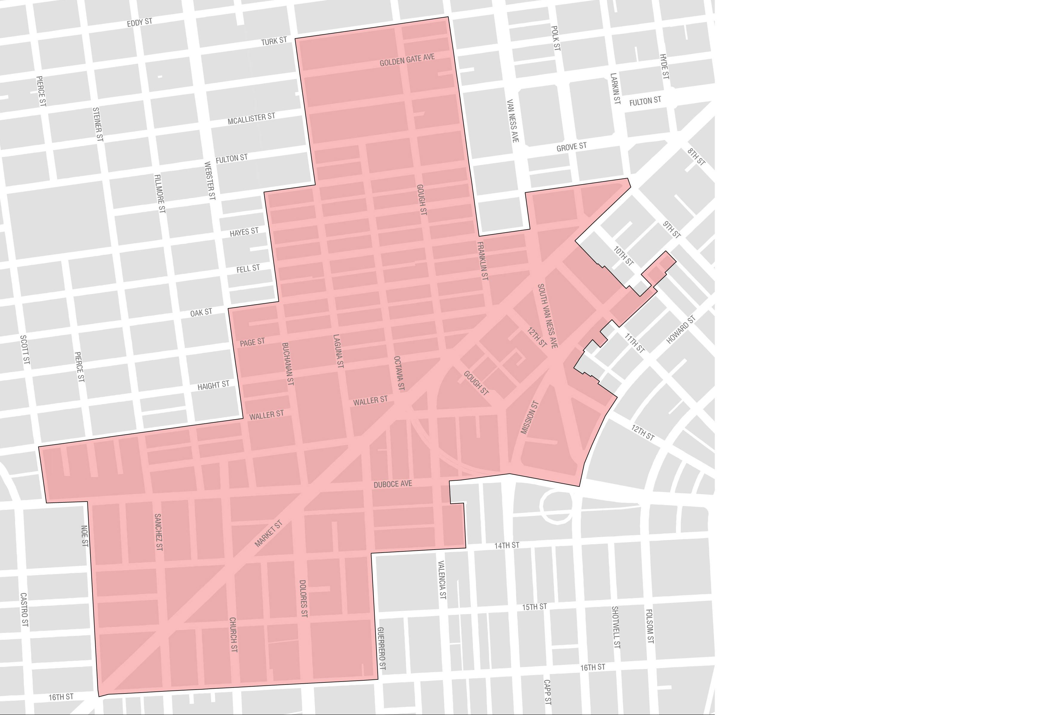
Market Octavia is located just west of the Civic Center, where governmental and cultural institutions attract visitors both day and night. Its pattern of streets and alleys make it walkable and bikeable. More than a dozen transit lines cross the neighborhood, including all of the city’s core streetcar lines. It is accessible from the entire Bay Area by BART and the regional freeway system.
Transit Center
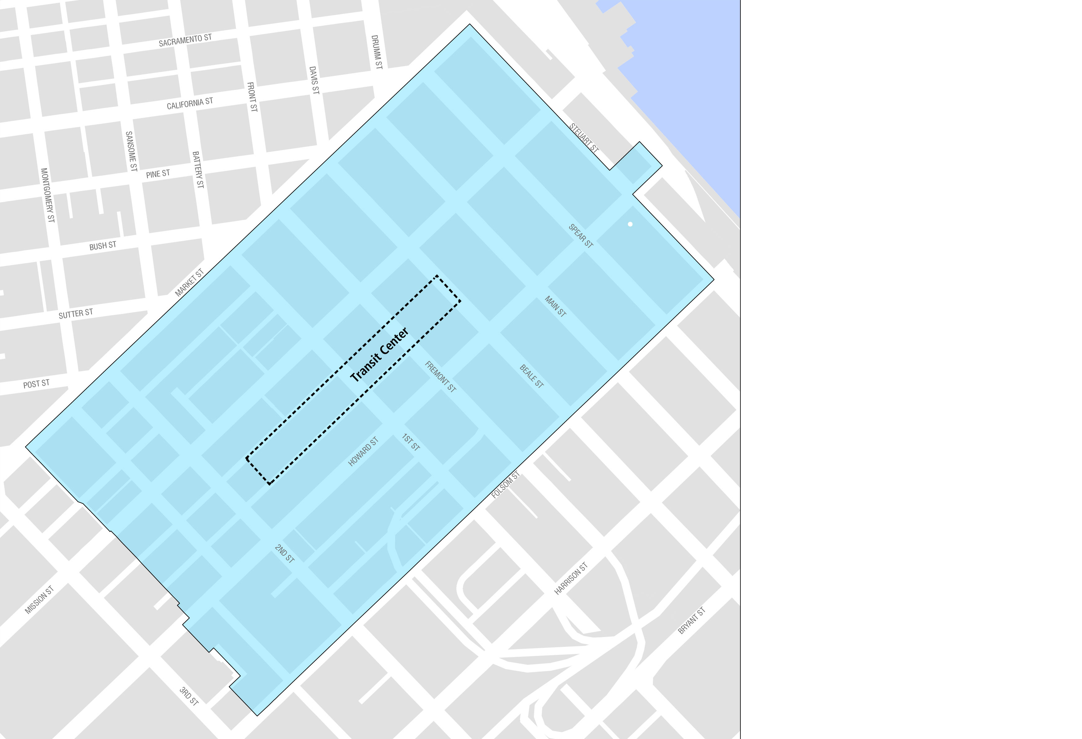
The Transit Center District Plan was adopted in 2012 to provide infrastructure improvements in conjunction with the opening of the Salesforce Transit Center. The Salesforce Transit Center is a $2.2 billion transportation hub that replaces the old Transbay Terminal and connects 11 regional transportation providers to downtown San Francisco. In addition to passengers arriving at the Transit Center, the Plan also includes several commercial developments.
Rincon Hill
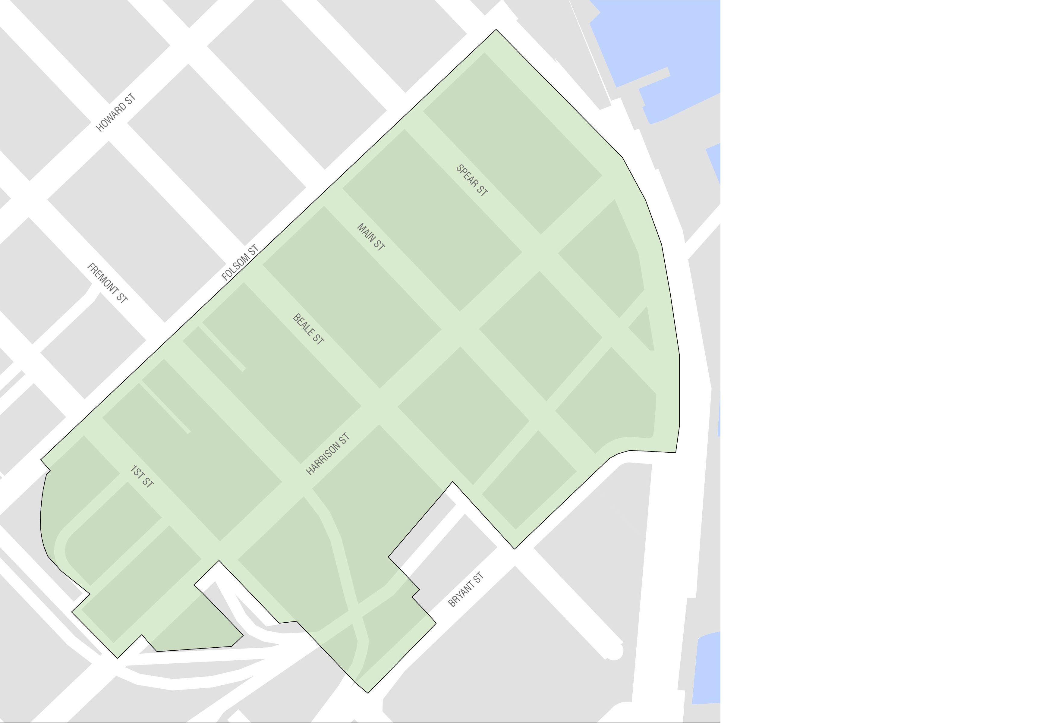
Rincon Hill is located in the northeast section of San Francisco, close to the Bay Bridge. Historically the neighborhood has contained many vacant lots and underutilized parcels, which have been rezoned for housing. Additionally, new parcels were opened up for development after the Embarcadero Freeway was demolished in 1991. Rincon Hill is accessible to many transit lines including the Muni Metro system and BART at Embarcadero station, which make Rincon Hill a strategic area to construct new housing in San Francisco.
Visitacion Valley
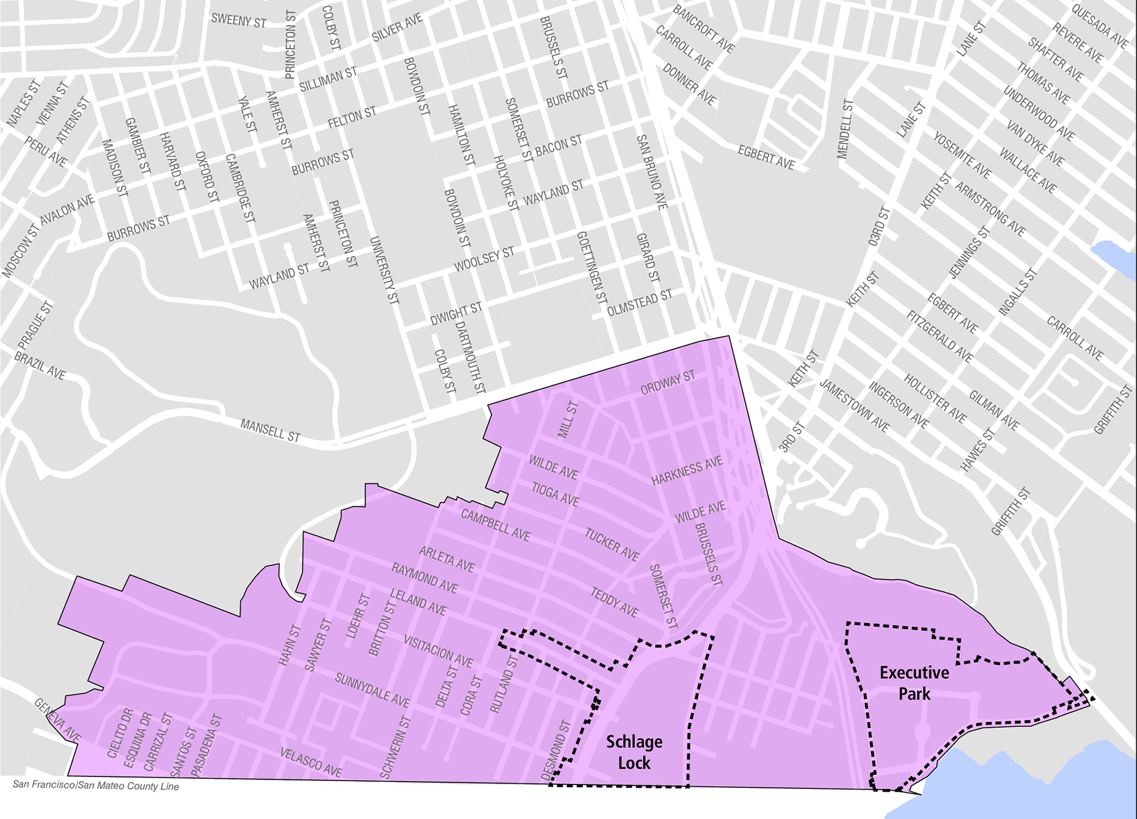
Visitacion Valley is located in southeast San Francisco, near the Brisbane border. In 1999, the Schlage Lock company decided to close its factory located in the area. The now-vacant site presents opportunities for new uses. New developments in the area are expected to produce a net increase of 4,800 housing units, 140,000 square feet of commercial/retail space, and 75,000 square feet of community space over at least ten years. An impact fee was implemented in 2005 for Visitacion Valley in anticipation of higher density development planned for Executive Park, the sub-area immediately east of the 101 Highway, Sunnydale HOPE SF, and Schlage Lock.