| Project Name | Description |
|---|---|
| Port – Seawall Resilience Project |
The Seawall Resilience Project will improve earthquake safety and performance of the Embarcadero Seawall, provide near-term flood protection improvements, and plan for additional long-term resilience and adaptation of the northern Bayfront. The overarching goals are to: improve earthquake safety without delay, reduce earthquake damage and disruption, lower flood risk, enhance the San Francisco Bay, and create a stable foundation for sea level rise adaptation.
Recognizing that a project of this magnitude will occur over several decades and require federal, state, and local permitting and funding, the Port Commission has approved a two-pronged approach that includes (1) planning and completing the improvements needed to address the most immediate life safety and high-priority upgrades to the Seawall; and (2) defining requirements for subsequent work to complete the Seawall’s resilience strengthening.
The budget for the Seawall Resiliency Project is currently estimated at $500 million. The City has committed $9.6 million through FY2018 for the initial planning component of Phase 1, with $5.6 million scheduled prior to this 10-year plan period and $4.0 million identified for FY2018. The Plan proposes a $350 million General Obligation Bond for voter approval in November 2018. The Port is leading the development of a funding strategy for the deferred need that may include seeking the State share of tax increment from the Mission Rock development project Infrastructure Financing District and working with the US Army Corps of Engineers to identify a flood control project under the authority of the Water Resources Development Act. This variety of funding sources aims to spread the cost of the project across a range of constituencies that have an interest in preserving infrastructure that supports a National Historic District, major transit routes that serve millions daily, and embarkation sites that will be critical for the City’s recovery in the event of a major earthquake. |
| Port – Mission Bay Ferry Landing |
The Mission Bay Ferry Landing will provide critical Transbay and regional ferry service to and from the fastest growing southern waterfront neighborhood of San Francisco, the financial district, and the East and North bays. The landing will provide capability to berth two ferry boats simultaneously and will likely include a nearby water taxi landing. The Port is entering into MOUs with the Bay Area Water Emergency Transportation Authority (WETA) to establish roles and responsibilities for the construction of the project as well as for the details and cost of ongoing operations, which WETA will bear.
|
| Port – Pier 70 20th Street Historic Buildings |
The 20th Street Historic Buildings are eight buildings at Pier 70, some dating back to the 1880s, that need substantial investment to return to active use. The Port has selected Orton Development Inc. for a public-private partnership to rehabilitate these buildings for use by office workers, retailers, artists, and manufacturing companies. Orton has commenced construction, and first occupancy is anticipated by summer 2017 with full buildout estimated by fall 2018.
|
| Port – Pier 70 Waterfront Site |
The Waterfront Site Project includes nine acres of waterfront parks, playgrounds, and recreation opportunities; new housing units (including 30% below market-rate homes); restoration and reuse of currently deteriorating historic structures; new and renovated space for arts, cultural, small-scale manufacturing, local retail, and neighborhood services; up to two million square feet of new commercial and office space; and parking facilities and other transportation infrastructure. The Port Commission selected Forest City California, Inc. as its development partner for the Pier 70 Waterfront Site. Construction is expected to commence in 2017, with full build-out completion in 10-15 years.
|
| Port – National Park Service Alcatraz Embarkation Site |
The National Park Service (“NPS”) and the Port are negotiating to develop a long-term, land-side home for an NPS welcome center for embarkation to Alcatraz Island, as well as an entry point for its many regional destinations in the Golden Gate National Recreation Area via ferry. NPS has partnered with the Golden Gate National Parks Conservancy on design and improvement plans for Pier 31 and Pier 33 Bulkhead buildings and the Pier 31 . marginal wharf.
|
| Port – Seawall Lot 337 and Pier 48 |
The vision for this project, led by Seawall Lot 337 Associates, LLC (an affiliate of the San Francisco Giants), is a flexible development that balances residential, office, retail, exhibition, and parking space in a combination of uses that will evolve to meet market demands, reflect community and regulatory concerns, and ensure mixed-use diversity. The Port anticipates that this project will generate new lease revenues, new property tax, Pay-Go, and bond revenues created through the formation of an Infrastructure Financing District, and result in overall higher property values.
|
| Port – Seawall Lots 323 and 324 |
In 2015 the Port Commission approved an agreement with Teatro ZinZanni and its financial partner, operating together as TZK Broadway, LLC, for the lease and development of Seawall Lots 323 and 324 for a dinner-theater, a maximum 200-room, 40-foot high boutique hotel, an approximately 7,500 square foot privately financed public park, and ancillary uses. The project is anticipated to be constructed and operational by 2019.
|
| Port – Seawall Lot 322-1 Development for Affordable Housing |
In 2014 the Port Commission approved an agreement between the Port and the Mayor’s Office of Housing and Community Development (MOHCD) regarding a joint effort to pursue the feasibility of improving Seawall Lot 322-1 with an affordable housing development. The project is scheduled for construction in 2018. MOHCD recently selected Bridge Housing as its private partner to develop the site with 130 family housing rental units.
The project's projected cost is $72 million. |
| Port – Downtown San Francisco Ferry Terminal Expansion Project |
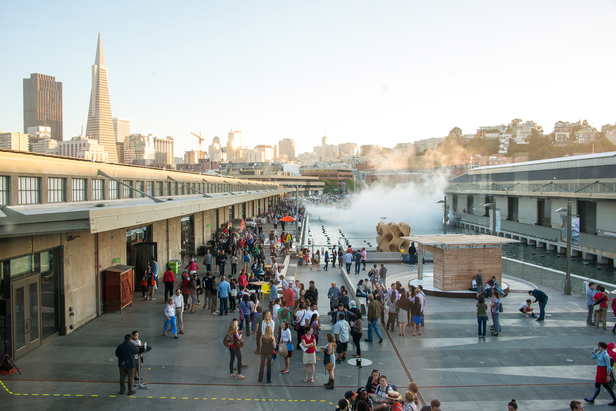
The Bay Area Water Emergency Transportation Authority (WETA) is developing the Downtown San Francisco Ferry Terminal Expansion project to expand and improve facilities at the ferry terminal. The expansion will accommodate anticipated increases in ferry ridership as new ferry services from downtown San Francisco to Richmond, Treasure Island, and other locations, are introduced through 2030. The project will include construction of two new ferry gates and four new berths, landside pedestrian circulation improvements, installation of amenities such as weather-protected areas for queuing, and covering of the current “lagoon” area south of the Ferry Building. This covered area will enhance emergency response capabilities and serve as a new public plaza in the heart of the Ferry Building area.
|
| Port – Agua Vista Park |
Agua Vista is a waterfront park at the southern edge of Mission Bay located on Terry Francois Boulevard at 16th Street that was originally improved in the 1970s. This project will renovate and connect the 20,000 square foot, shoreline Agua Vista Park to the recently improved edge of Bayfront Park. When completed, Agua Vista Park and the future Bayfront Park combined are expected to include 2,000 linear feet of new shoreline access, continuous walking and bike paths, and dramatic views of ships being worked on at the Pier 70 shipyard and dry dock. Improvements may include new pathways, seating areas, interpretation, and fishing facility improvements. The project is expected to be completed in 2017.
The budget for this project is $2 million dollars and is funded through the Neighborhood Parks G.O. Bond program. |
| Port – Blue Greenway Public Art |
Working with the San Francisco Arts Commission, the Port has identified the Bayview Gateway site as the appropriate site and location for an art enrichment project. Construction is anticipated to be complete in 2017.
The budget for this art enrichment project is $684,000 and is funded through the Neighborhood Parks G.O. Bond program. |
| Port – Islais Creek Improvements |
This project will complete the pathway along the northern shore of Islais Creek from I-280 to Illinois Street. New public access would connect the Islais Creek Promenade at Tennessee Street to the historic Third Street Bridge. Improvements are expected to include a new waterfront walkway and scenic lookout points. This site currently is partially unimproved. Improvements would close a gap in the Islais Creek system of open spaces, the Blue Greenway, and Bay Trail. The project is expected to be complete in 2017.
Improvements are budgeted at $2 million, and this project is funded through the Neighborhood Parks G.O. Bond program. |
| Port – Crane Cove Park Phases 1 and 2 |
Crane Cove Park is a new, approximately nine-acre, Blue Greenway waterfront park located in the Central Waterfront between 19th and Mariposa Streets east of Illinois Street. Initial park concepts include shoreline cleanup and stabilization, restoration of historic cranes, historic interpretation, bay access, and a facility for human powered boats. Phase 1 construction is underway, and completion is slated for 2018, and Phase 2 will support completion of a four acre site east of slipway 2.
|
| OCII Mission Bay – Parks and Open Space | Nineteen additional parks are anticipated to be constructed over the next 10 years, of which 13 are planned for delivery over the next five years. Parks anticipated to be finished by FY2019 include: remaining segments of the Mission Creek park loop, a new dog park to serve Mission Bay South, a small remaining segment of Mariposa parks to serve the new UCSF Children’s hospital and expanding Dogpatch neighborhood, the Commons linear park, a small pocket park and more. |
| OCII Mission Bay – Streetscape and Underground Utilities | While a significant amount of roadways in Mission Bay, along with their underground utility system, have been constructed since 1998, the need remains to finalize improvements to the core infrastructure serving the new residential neighborhood and research district in the southern portion of Mission Bay. This infrastructure includes new roadways, underground utilities, highway off-ramp improvements, and pedestrian and bicycle improvements. The majority of these improvements will be constructed over the next five years. |
| OCII Mission Bay – Storm Water Treatment | The remaining required storm water treatment improvements in Mission Bay are all located south of Mission Creek. This southern portion of Mission Bay will have a storm water treatment system separate from the combined sewer/storm water system found in the rest of the City to avoid additional burdens on the Southeast Treatment Facility. These improvements include construction of storm water pump stations and storm water treatment facilities, which are expected to be constructed within the next five years. |
| OCII Shipyard/Candlestick – Building 101 & Artists Replacement Studios | Building 101 will be retained as part of the Shipyard redevelopment and will require significant upgrades in the future. New artist studios for approximately 100 artists will be constructed. |
| OCII Shipyard/Candlestick - New Parks and Open Space | The development will build out several new parks which include: Hillpoint Park, Hilltop Pocket Parks, Innes Court Park, Coleman Promenade and Overlook, Storehouse Plaza, Coleman Bluffs Paths, Hillside Central Park, Jamestown Walker Slope, Wedge Park, Bayview Hillside Open Space, and Alice Griffith Community Garden, Northside Park, Horne Blvd Park, Shipyard Hillside Open Space, Mini-Wedge Park, Earl Blvd Park, Waterfront Promenade North/South, Heritage Park, and Alice Griffith Neighborhood Park. |
| OCII Shipyard/Candlestick – Transportation Improvements | The Shipyard/Candlestick Point project includes an extensive program of on-site and off-site transportation improvements to facilitate automobile, transit, bicycle, and pedestrian mobility in and around the project area. Over the next five years, the master developer will build out a new network of streets in the former Candlestick Stadium site to serve a new retail center and the Alice Griffith public housing site. |
| OCII Shipyard/Candlestick – Streetscape Projects | The Shipyard/Candlestick Point Project will enhance the walkability of several streets, providing new amenities to pedestrians in the area by performing streetscape projects on Gilman Street, Harney Way, and Innes Avenue. |
| OCII Transbay – Folsom Street Improvements |
Planned improvements to Folsom Street in the Transbay area include widened sidewalks with special paving, new street trees, rain gardens, and new streetlights and traffic signals. Construction of improvements is anticipated to begin in 2017, with completion of all permanent improvements by 2019.
The total cost of the Folsom Street improvements is $18 million and will be funded by tax exempt bonds issued by OCII. |
| OCII Transbay – New Public Park (between Main & Beale) |
Within the next five years, OCII will complete construction of a new 1.1-acre park north of Folsom Street, between Main and Beale Streets, adjacent to the site of the Temporary Transbay Terminal. The TJPA plan has programmed the site for approximately 730 new residential units surrounding the new park. Construction of the park is expected to begin in 2018.
|
| OCII Transbay – Greater Rincon Hill Community Benefit District |
In 2015 property owners within Transbay and the Rincon Hill neighborhoods approved the Greater Rincon Hill Community Benefit District. The District provides funding for maintenance of the new infrastructure, including the new parks, sidewalk and street cleaning, security, and programming for neighborhood events.
The District produces approximately $4.5 million in funding annually to meet these needs. |
| TIDA – Horizontal Infrastructure | Treasure Island requires significant investment in modernizing its horizontal infrastructure, which is needed to ensure that the Island is in the developable condition necessary for new buildings and structures to be built upon it. This investment includes building a replacement low-pressure potable water system, a reclaimed water system, new sanitary sewer and storm drainage facilities, and joint trenches throughout the area to accommodate electrical, communication, and gas utilities. |
| TIDA – Public Open Spaces | Improvements to public open space will include public access trails, parks, shoreline improvements and other waterfront improvements to enhance public use, and enjoyment of views of the San Francisco Bay. |
| TIDA – Transportation Improvements | Public transportation improvements will include a new ferry terminal, lease payments for new ferry boats, and the cost to purchase or lease shuttle buses for the new on-island free shuttle service. A transportation operating subsidy to enhance funding for the project’s unique transit services and transportation demand management programs as defined by the DDA and Transportation Plan. |
| Planning – Neighborhood Development Plan Areas | Please see the following pages to find an overview of the infrastructure enhancement projects planned for each of the Plan Areas governed by the Interagency Plan Implementation Committee (IPIC): Balboa Park, Eastern Neighborhoods, Market/Octavia, Rincon Hill, Transit Center, and Visitacion Valley. The projects and associated costs discussed in this section are based on the original Area Plans that were developed when the enabling legislation which established the plan areas was enacted. Since that time, additional projects for these areas have been identified. |
Balboa Park
The Balboa Park area is expected to build 1,780 new housing units, generating approximately $1.6 million in impact fee revenue through FY2027. Infrastructure investments in the Balboa Park Area Plan include pedestrian and streetscape improvements along Ocean and Geneva Avenues, additional open spaces adjacent to Ingleside Library and as part of the potential Balboa Reservoir development, and realigning freeway ramps. The Area Plan also includes significant improvements at the Balboa Park BART and Muni station.
Table 6.1 - Enhancement Projects
| Balboa Park Area Plan Projects by Category | |
|---|---|
| Original Area Plan Projects: | Count |
| Open Space | 8 |
| Streetscape | 4 |
| Bikes | 2 |
| Community Facility | 2 |
| Transit | 1 |
| Total | 17 |
Table 6.2
| Overview of Balboa Park Area Plan Project Funding | ||||
|---|---|---|---|---|
| Complete Streets | Open Space | Transit | Grand Total | |
| Total Cost of Area Plan Projects | 13,100,000 | 10,100,000 | - | 23,200,000 |
| Source of Funds: | - | |||
| Impact Fees | 476,000 | 373,000 | 166,000 | 1,015,000 |
| General Fund | - | 3,000,000 | - | 3,000,000 |
| GO Bonds | - | - | - | - |
| Other Local | - | - | - | - |
| State/Federal | - | 2,900,000 | - | 2,900,000 |
| Sources of Funds Subtotal | 476,000 | 6,273,000 | 166,000 | 6,915,000 |
| Surplus (Deficit) | -12,624,000 | -3,827,000 | 166,000 | -16,285,000 |
| Funded Emerging Needs | 8,516,000 | 10,505,000 | 15,484,000 | 34,505,000 |
| Unfunded Emerging Needs | -2,805,000 | -26,695,000 | 70,000 | -29,430,000 |
| Total Surplus (Deficit) | -15,429,000 | -30,522,000 | 236,000 | -45,715,000 |
Eastern Neighborhoods
The Eastern Neighborhoods are among the City’s highest growth areas; the Area Plan enables approximately 12,000 additional housing units and 20,000 new jobs. The Eastern Neighborhoods Area Plan is vast and calls for over 90 different projects to be implemented. Highlights in the Area Plan include transit improvements to the 16th Street bus corridor, rehabilitation to the Mission Recreation Center, and redevelopments at Jackson Playground in Potrero Hill.
The City currently estimates approximately $397 million will be needed to serve new growth through FY2027, and the Capital Plan identifies $288 million over the next 10 years.
Table 6.3 - Enhancement Projects
| Eastern Neighborhoods Area Plan Projects by Category | |
|---|---|
| Project Type | Amount |
| Streetscape | 49 |
| Open Space | 25 |
| Transit | 13 |
| Bikes | 9 |
| Community Facility | 3 |
| Total | 99 |
Table 6.4
| Overview of Eastern Neighborhoods Area Plan Project Funding | ||||
|---|---|---|---|---|
| Complete Streets | Open Space | Transit | Grand Total | |
| Total Cost of Area Plan Projects | 167,070,001 | 136,035,000 | 94,429,947 | 397,534,948 |
| Source of Funds: | ||||
| Impact Fees | 42,660,000 | 49,655,000 | 26,704,000 | 119,019,000 |
| General Fund | 21,884,959 | 12,750,000 | 10,130,000 | 44,764,959 |
| GO Bonds | 13,961,525 | 12,000,000 | 41,165,937 | 67,127,462 |
| Other Local | 6,488,632 | 2,700,000 | 11,774,063 | 20,962,695 |
| State/Federal | 19,621,085 | - | 1,667,947 | 21,289,032 |
| Sources of Funds Subtotal | 104,616,201 | 77,105,000 | 91,441,947 | 273,163,148 |
| Surplus (Deficit) | -62,453,800 | -58,930,000 | -2,988,000 | -124,371,800 |
| Funded Emerging Needs | 27,000,596 | 54,744,000 | 8,640,000 | 90,384,596 |
| Unfunded Emerging Needs | -75,150,000 | -11,128,000 | -30,200,000 | -116,478,000 |
| Total Surplus (Deficit) | -137,603,800 | -70,058,000 | -33,188,000 | -240,849,800 |
Market/Octavia
The Market/Octavia Area Plan envisions 5,500 new residential units housing 10,000 additional people in the neighborhood. To accommodate this projected growth, the Area Plan calls for enhancements including the upcoming Van Ness Bus Rapid Transit Project, improvements to the 5-Fulton and 71-Haight bus lines, renovation of Margaret Hayward Park, bicycle infrastructure on Page Street, and various traffic calming and pedestrian safety improvements.
The City currently estimates approximately $27 million will be needed for Market/Octavia through FY2027, and the Capital Plan identifies $25 million in funding to meet these needs.
Table 6.5 - Enhancement Projects
| Market/Octavia Area Plan Projects by Category | |
|---|---|
| Project Type: | Amount |
| Streetscape | 16 |
| Open Space | 3 |
| Transit | 3 |
| Total | 22 |
Table 6.6
| Overview of Market/Octavia Area Plan Project Funding | ||||
|---|---|---|---|---|
| Complete Streets | Open Space | Transit | Grand Total | |
| Total Cost of Area Plan Projects | 17,991,257 | 24,855,367 | - | 42,846,624 |
| Source of Funds: | ||||
| Impact Fees | 16,801,257 | 11,094,000 | - | 27,895,257 |
| General Fund | - | - | - | - |
| GO Bonds | - | 14,000,000 | - | 14,000,000 |
| Other Local | - | - | - | - |
| State/Federal | - | - | - | - |
| Sources of Funds Subtotal | 16,801,257 | 25,094,000 | - | 41,895,257 |
| Surplus (Deficit) | -1,190,000 | 238,633 | - | -951,367 |
| Funded Emerging Needs | 3,530,186 | - | 7,000,000 | 10,530,186 |
| Unfunded Emerging Needs | -15,703,830 | - | -500,000 | -16,203,830 |
| Total Surplus (Deficit) | -16,893,830 | 238,633 | -500,000 | -17,155,197 |
Rincon Hill
The Rincon Hill Area Plan enables over 2,500 additional residential units in the neighborhood. To accommodate this growth, the Rincon Hill Streetscape Plan includes park and streetscape improvements for the neighborhood.
The Planning Department estimates another $3.8 million in impact fees between FY2018 and FY2027 for additional priority improvements, which will cover streetscape and open space improvements in the Plan Area. In 2011, criteria were established regarding the use of an Infrastructure Financing Districts in Plan Areas with significant upzoning. Subsequently, an Infrastructure Financing District for Rincon Hill was established that could potentially cover these costs.
Table 6.7 - Enhancement Projects
| Rincon Hill Area Plan Projects by Category | |
|---|---|
| Project Type: | Amount |
| Streetscape | 13 |
| Open Space | 1 |
| Total | 14 |
Table 6.8
| Overview of Rincon Hill Area Plan Project Funding | |||
|---|---|---|---|
| Complete Streets | Open Space | Grand Total | |
| Total Cost of Area Plan Projects | 40,343,000 | 6,328,500 | 46,671,500 |
| Source of Funds: | |||
| Impact Fees | 20,164,000 | 5,686,000 | 25,850,000 |
| General Fund | - | - | - |
| GO Bonds | - | - | |
| Other Local | - | - | - |
| State/Federal | - | - | - |
| Sources of Funds Subtotal | 20,164,000 | 5,686,000 | 25,850,000 |
| Surplus (Deficit) | -20,179,000 | -642,500 | -20,821,500 |
| Funded Emerging Needs | - | - | - |
| Unfunded Emerging Needs | -1,118,000 | - | -1,118,000 |
| Total Surplus (Deficit) | -21,297,000 | -642,500 | -21,939,500 |
Transbay Transit Center
The Transit Center District Plan, adopted in 2012, enables about 3,500 additional residential units and about 6.5 million square foot of new commercial space (office and retail) near the new Transbay Transit Center.
The Planning Department projects over $134 million in impact fee revenues available for infrastructure in the Transit Center District through FY2020. Nearly $35 million of these impact fees are set aside for open space improvement projects, and the other $99 million are to be used for transit and streetscape improvements. Additional information about the Transbay Transit Center can be found in the Transportation chapter of this Plan.
Table 6.9 - Enhancement Projects
| Transit Center Area Plan Projects by Category | |
|---|---|
| Project Type | Amount |
| Streetscape | 13 |
| Open Space | 3 |
| Transit | 2 |
| Total | 18 |
Table 6.10
| Overview of Transit Center Area Plan Project Funding | ||||
|---|---|---|---|---|
| Complete Streets | Open Space | Transit | Grand Total | |
| Total Cost of Area Plan Projects | 21,225,000 | 9,000,000 | 29,000,000 | 59,225,000 |
| Source of Funds: | ||||
| Impact Fees | 21,225,000 | 24,000,000 | 35,977,000 | 81,202,000 |
| General Fund | - | - | - | - |
| GO Bonds | - | - | - | - |
| Other Local | - | - | - | - |
| State/Federal | - | - | - | - |
| Sources of Funds Subtotal | 21,225,000 | 24,000,000 | 35,977,000 | 81,202,000 |
| Surplus (Deficit) | - | 15,000,000 | 6,977,000 | 21,977,000 |
| Funded Emerging Needs | - | - | - | - |
| Unfunded Emerging Needs | - | - | -16,000,000 | -16,000,000 |
| Total Surplus (Deficit) | - | 15,000,000 | -9,023,000 | 5,977,000 |
Visitacion Valley
Visitacion Valley is expected to lead to an increase of 4,800 housing units, 128,000 square feet of commercial space, and 90,000 square feet of community space. Infrastructure projects to be implemented in Visitaction Valley include renovations to Visitacion Valley Playground, pedestrian improvements on Arleta Avenue, and bicycle network improvements on Geneva Avenue.
Over the next years, the Planning Department projects approximately $22 million in fee revenue, including in-kind improvements at Schlage Lock.
Table 6.11 - Enhancement Projects
| Visitacion Valley Area Plan Projects by Category | |
|---|---|
| Project Type | Amount |
| Streetscape | 12 |
| Open Space | 6 |
| Bikes | 3 |
| Transit | 1 |
| Total | 22 |
Table 6.12
| Overview of Visitacion Area Plan Project Funding | ||||
|---|---|---|---|---|
| Complete Streets | Open Space | Transit | Grand Total | |
| Total Cost of Area Plan Projects | - | - | 13,400,000 | 13,400,000 |
| Source of Funds: | ||||
| Impact Fees | 7,066,000 | 3,900,000 | 1,012,000 | 11,978,000 |
| General Fund | - | - | - | - |
| GO Bonds | - | - | - | - |
| Other Local | - | - | - | - |
| State/Federal | - | - | - | - |
| Sources of Funds Subtotal | 7,066,000 | 3,900,000 | 1,012,000 | 11,978,000 |
| Surplus (Deficit) | 7,066,000 | 3,900,000 | -12,388,000 | -1,422,000 |
| Funded Emerging Needs | 10,658,000 | 3,796,000 | - | 14,454,000 |
| Unfunded Emerging Needs | -5,260,000 | -7,804,000 | 3,096,000 | -9,968,000 |
| Total Surplus (Deficit) | 1,806,000 | -3,904,000 | -9,292,000 | (11,390,000) |